Products
Multi-frequency GBSAR
Balamis Multi-frequency GBSAR is a flexible Ground-Based Synthetic Aperture Radar for slope stability and structures monitoring. It targets customers and researchers who have to deal with complex stability studies where vegetation or snow cover difficult proper measurements. The use of multiple frequency bands assists the compensation of atmospheric artifacts, vegetation and/or snow cover and moisture presence.
It is also an optimal tool for ground truth and preparation of future satellite mission providing hiper-temporal multi-band data of current and future space-borne SAR systems.
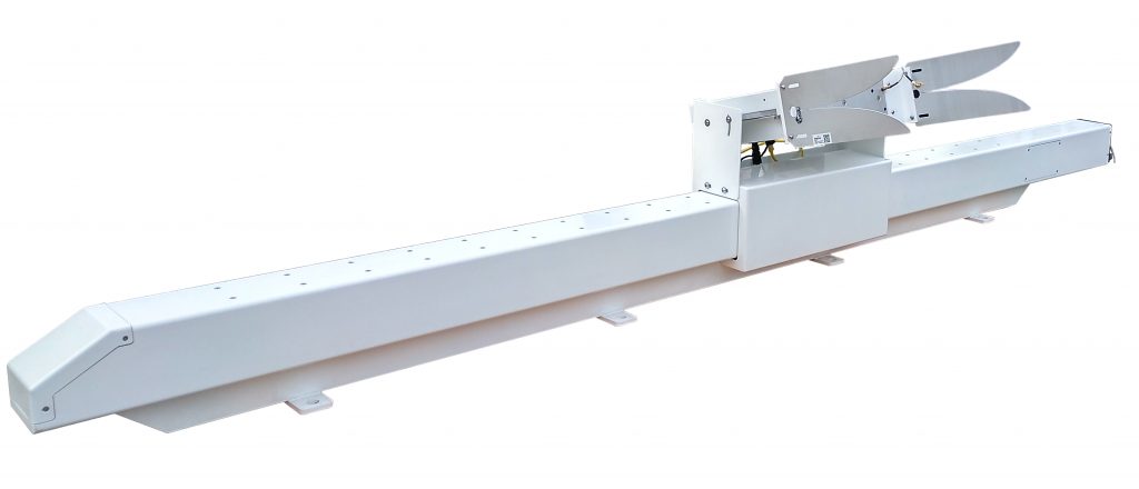
Advantages
- Constant monitoring fully autonomous
- Displacement measurement by remote sensing
- Long range measurement, up to 4 km
- Compatible with most common GIS software
Applications
Civil Engineering / Minning
- Tailing dam monitoring
- Slope stability
- Structural monitoring
Agriculture / Environment
- Geohazard prevention and mitigation
- Support to the validation of forestry and moisture models
Other
- Earth Observation, validation of satellite data
Band
X
C
L
P
S*
Ku*
Frequency
9.6 GHz
5.4 GHz
1.27 GHz
0.45 GHz
3.2 GHz
17.2 GHz
Bandwidth
200 MHz
200 MHz
160 MHz
80 MHz
160 MHz
200 MHz
Range resolution
0.75 m
0.75 m
0.93 m
1.87 m
0.93 m
0.75 m
Azimuth resolution @ 1 km
7.8 m
13.8 m
59 m
172 m
23.4 m
4.4 m
* S and Ku bands are available upon request. They are added by replacing P-band. In case you need other configurations, please contact us.
Acquisition time
On-The-Fly operation mode
· 10 s per frequency
· 2 min for all four frequencies
Stop and Go operation mode
· 3 min per frequency
· 15 min for all four frequencies
Output power
27 dBm
Aperture lengh
2 m
Weight
100 kg
Please note, single frequency GBSAR’s are also available. If it is of your interest, please contact us.
ARIEL L-band microwave radiometer
For large extensions and mobile platforms
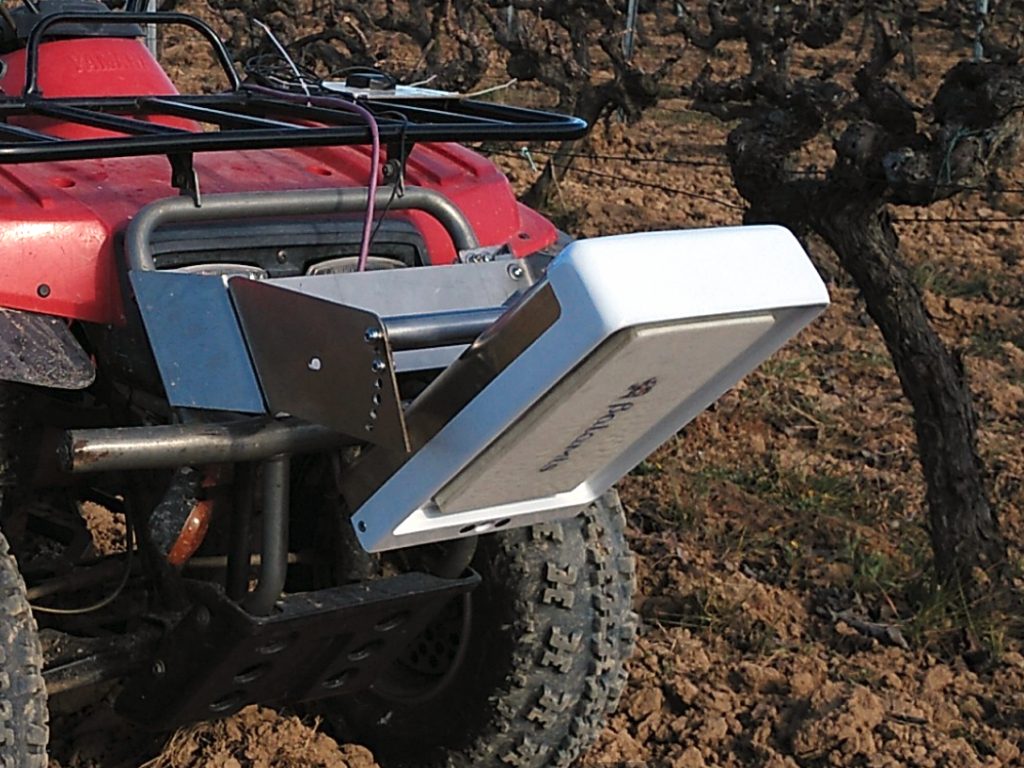
ARIEL is a microwave radiometer that can be used for soil moisture remote sensing. It is based on the same technology used by the instrument MIRAS on-board the ESA SMOS satellite mission.
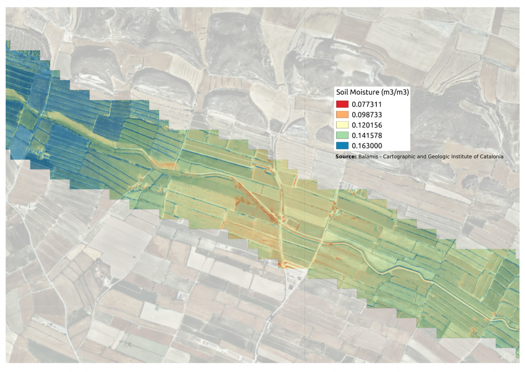
Advantages
- Large extension can be covered without requiring infrastructure
- Configuration through web-based user interface
- To be used on board aircrafts, drones, and ground vehicles.
- Compatible with most common GIS software
Applications
Agriculture / Environment
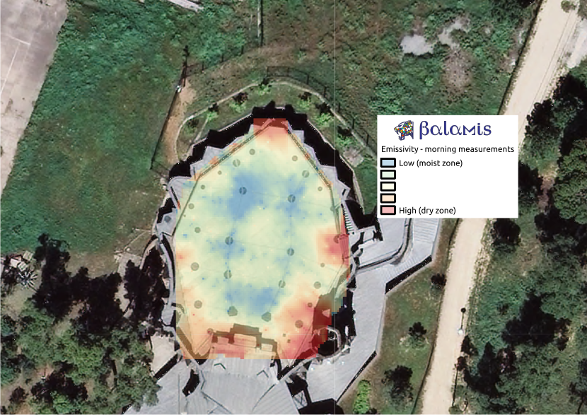
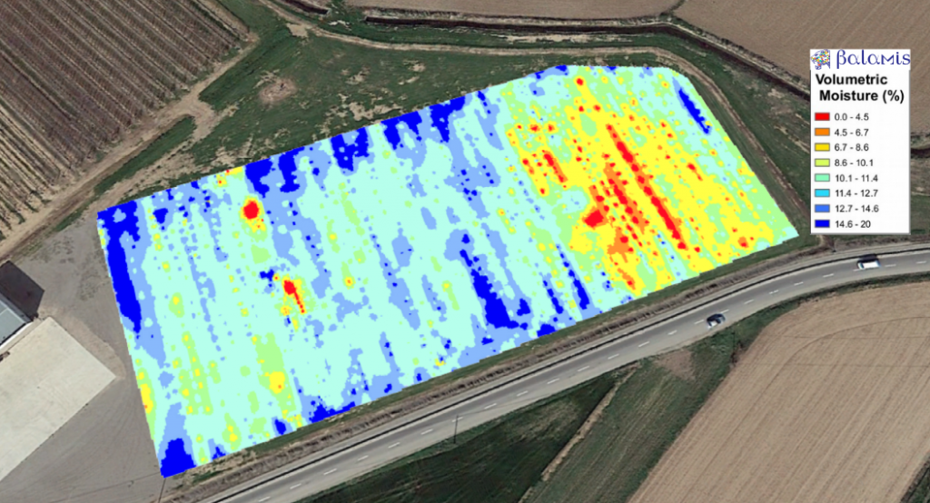
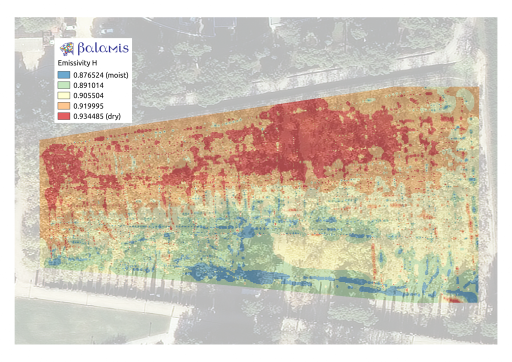
- Soil and soil moisture variability
- Puddle detection with vegetation cover
- Irrigation planning
- Land management
Civil Engineering / Minning
- Levee inspection
- Tunnel and galleries inspection
- Surface moisture in linear infrastructure
Other
- Earth Observation, validation of satellite data
- Telcomm, location of sources of electromagnetic interferences
- Thin sea ice thickness studies
ARIEL series
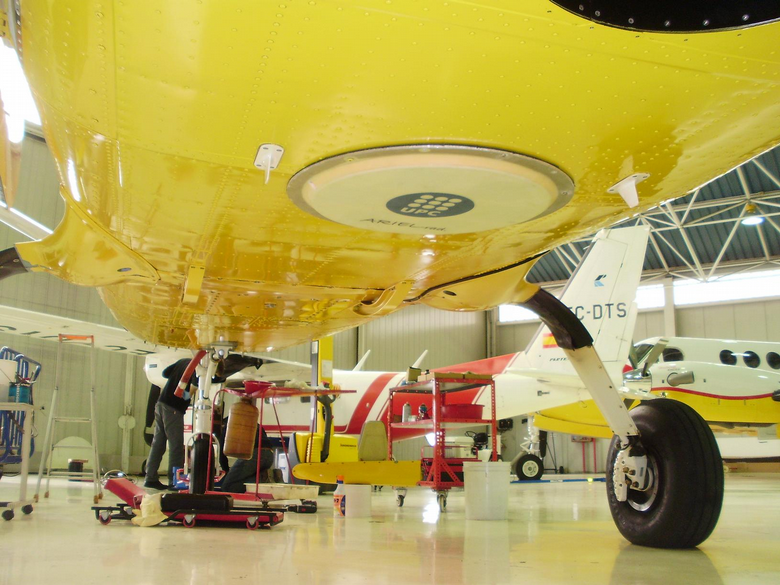
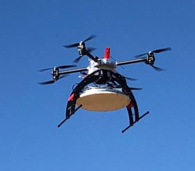
Examples

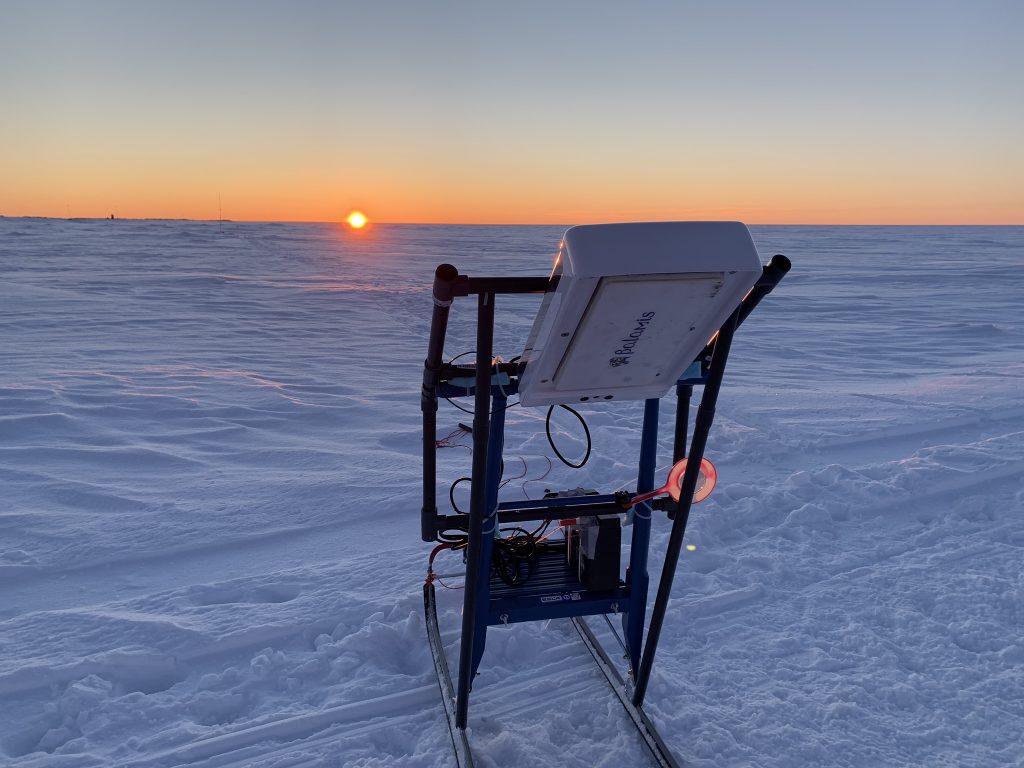
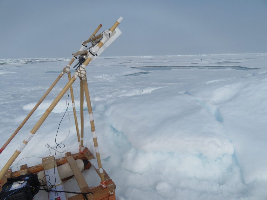
L-band radiometer
· Central frequency: 1.413 GHz
· Bandwidth: 20MHz
· Radiometric accuracy: 1 K at 1 Hz
· Sampling rate: up to 10 Hz
Patch array antenna
· Dual polarization (H+V)
· Beamwidth: 37º (ground version), 37º (UAV), 22º (aircraft).
Power input
· Voltage: 12 V
· Electronics current consumption: 0.5 A
· Heating system: 1 A (ground and UAV), 4 A (aircraft)
Weight
· 6 kg (ground), 2.8 kg (UAV), 15 kg (aircraft)
Positioning
· GPS, Glonass, Beidou integrated receiver
· WGS84 EPSG, 4326 format
Data
· Internal storage
· Ethernet interface communication
Configuration
· ARIEL is configurable using a web-based user interface
Processing software
· RAW data into brightness temperature software included
· Brightness temperature to soil moisture conversion software optional
· WGS84 EPSG, 4326 format
Airborne soil moisture determination using a data fusion approach at regional level
Martin, F.; Marchan, J.F.; Aguasca, A.; Vall-llossera, M.; Corbera, J.; Camps, A.; Piles, M.; Pipia, L.; Tarda, A.; Villafranca, A.G.
Geoscience and Remote Sensing Symposium (IGARSS), 2011 IEEE International
On the use of compact L-band Dicke radiometer (ARIEL) and UAV for soil moisture and salinity map retrieval: 2008/2009 field experiments
Acevo-Herrera, R.; Aguasca, A.; Bosch-Lluis, X.; Camps, A.
Geoscience and Remote Sensing Symposium,2009 IEEE International,IGARSS 2009
SMIGOL
L-band GNSS reflectometer
For local constant monitoring and sensor networks
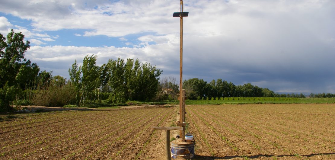
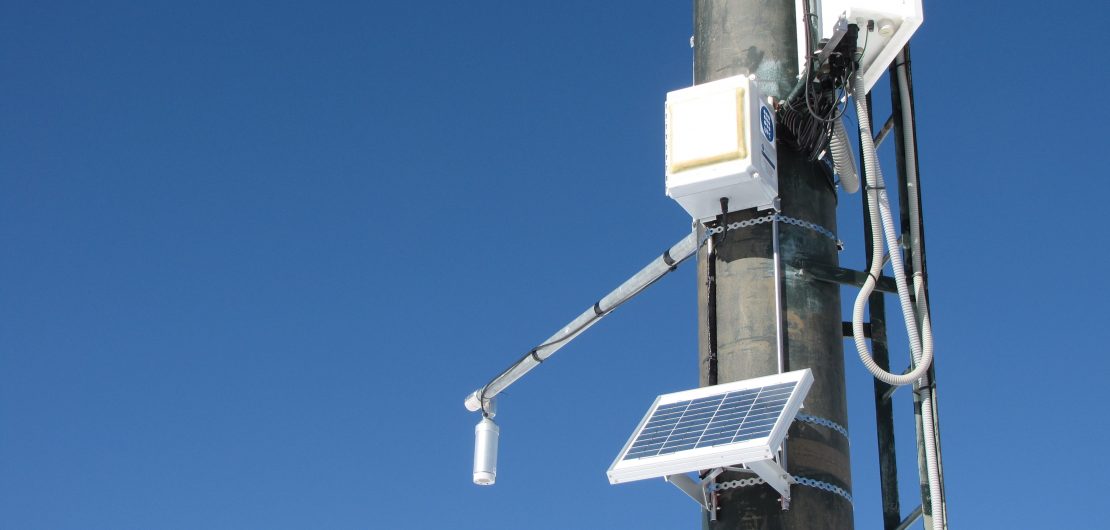
This sensor can be understood as a bi-static radar where the GPS satellite is the emitter and SMIGOL the receiver. SMIGOL analyzes the difference between the signal received directly on the sensor and the one reflected from ground to the sensor. The difference between these two signals can be used to obtain soil related measurements.
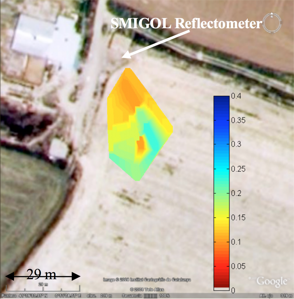
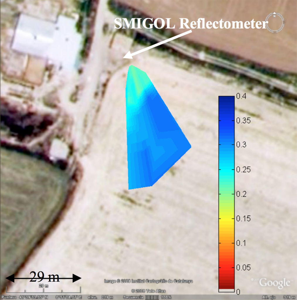
Advantages
- Soil moisture and altimetry measurements
- Data is obtained through non invasive methods: not interfered by animals nor ground vehicles.
- To be installed on a pole. Area covered: three times pole height
- Fully autonomous: fed by solar panels, and data transmitted via GPRS receiver.
Applications
Agriculture / Environment
- Local soil moisture
- Irrigation planning
- Vegetation heigh
Civil Engineering / Minning
- Levee monitoring
- Water level measurement
Snow Thickness Monitoring Using GNSS Measurements
Rodriguez-Alvarez, N.; Aguasca, A.; Valencia, E.; Bosch-Lluis, X.; Camps, A.; Ramos-Perez, I.; Hyuk Park; Vall-llossera, M.
Geoscience and Remote Sensing Letters, IEEE
GO TO ABSTRACT
Soil Moisture Retrieval Using GNSS-R Techniques: Experimental Results Over a Bare Soil Field
Rodriguez-Alvarez, N.; Bosch-Lluis, X.; Camps, A.; Vall-llossera, M.; Valencia, E.; Marchan-Hernandez, J.F.; Ramos-Perez, I.
Geoscience and Remote Sensing, IEEE Transactions on
GO TO ABSTRACT
Soil moisture and vegetation height retrieval using GNSS-R techniques
Rodriguez-Alvarez, N.; Monerris, A.; Bosch-Lluis, X.; Camps, A.; Vall-llossera, M.; Marchan-Hernandez, J.F.; Ramos-Perez, I.; Valencia, E.; Martinez-Fernandez, J.; Sanchez-Martin, N.; Baroncini-Turricchid, G.; Perez-Gutierrez, C.
Geoscience and Remote Sensing Symposium,2009 IEEE International,IGARSS 2009
GO TO ABSTRACT
Vegetation Water Content Estimation Using GNSS Measurements
Rodriguez-Alvarez, N.; Bosch-Lluis, X.; Camps, A.; Ramos-Perez, I.; Valencia, E.; Hyuk Park; Vall-llossera, M.
Geoscience and Remote Sensing Letters, IEEE
GO TO ABSTRACT
Water level monitoring using the interference pattern GNSS-R technique
Rodriguez-Alvarez, N.; Bosch-Lluis, X.; Camps, A.; Ramos-Perez, I.; Valencia, E.; Park, H.; Vall-llossera, M.
Geoscience and Remote Sensing Symposium (IGARSS), 2011 IEEE International
GO TO ABSTRACT